
From the moment we signed our contract to move to Chile, Torres del Paine National Park was on our minds. This park is at or near the top of many adventure travelers’ lists, and the iconic “W” hike is considered by many as one of the best all around multi-day hikes in the world.
Located on the Chilean side of Southern Patagonia, Torres del Paine is incredibly remote and known for extreme weather conditions. Due to this, it’s only advisable to tackle this hike during the late spring-early fall. Because we moved to Chile in February, near the end of the Southern Hemisphere’s summer, we missed our window last season. But, quickly set our sights on this spring to make the trip and tackle the hike.
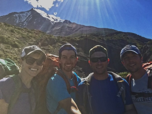
After discussing with our friends Andrew and Michael, who wanted to travel down and join us, we settled on late November. This would allow them to take advantage of extra days off over the Thanksgiving holiday, and allowed us to beat the summer crowds that typically pick up starting in December.
With our dates set, the planning began. This certainly isn’t the simplest trip to plan, but it’s well worth the hassles. I plan to try and lay out more of the particulars in a future post, but suffice it to say that planning involved coordination of planes, buses, boats and campsite reservations using a variety of sketchy websites and phone-based reservation systems.
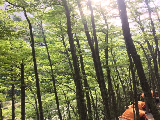
We planned our trip to last a total of 7 nights, 5 of which we spent camping in the park, and 2 of which were spent in a hotel Puerto Natales, the nearest town. The traditional hike lasts 4 nights, but we spent an extra night at the beginning of our hike near Glacier Grey so that we could do an ice hike. Again, check back for more details on packing, logistics, etc. but for now, here are some highlights of the hike.
Day 1: Puerto Natales to Glacier Grey
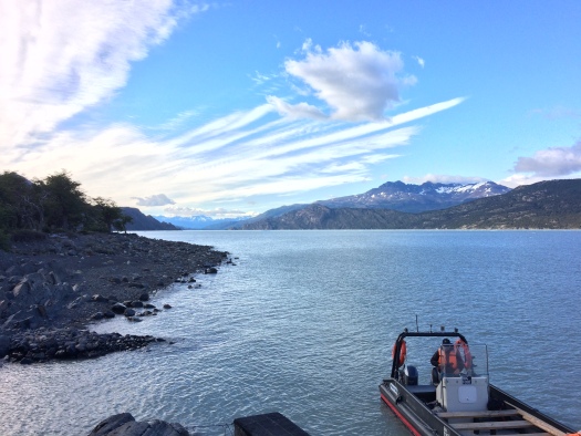
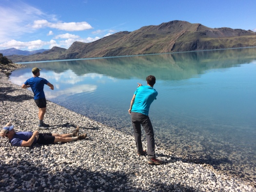
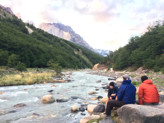
We woke up early in Puerto Natales, and caught a 7AM bus into the park. After purchasing our park tickets and watching a quick safety video, we were dropped off on the shore of Lago Pehoe, where we took a catamaran to the trailhead. While the catamaran ride was a necessary means of transportation to enter the park, it also offered some absolutely breathtaking views out across the crystal blue waters.
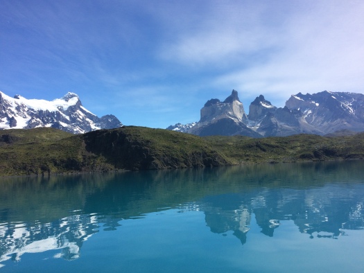
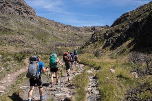
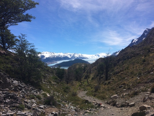
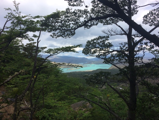
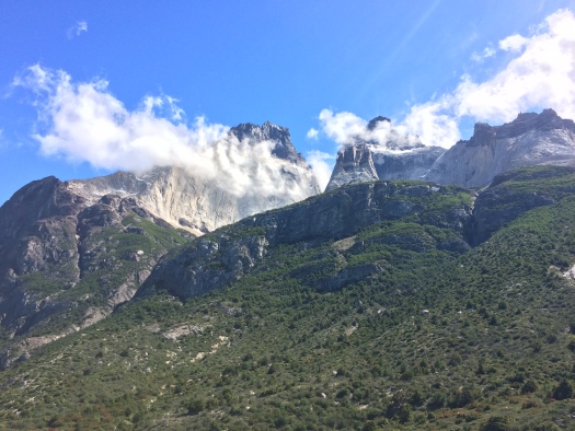
After disembarking the catamaran, we ate a quick snack and then set out for the first leg our our hike. The “W” gets its name from the trail’s shape. The legs of the “W” take you up into 3 different valleys, and the humps at the bottom travel along some incredibly beautiful lakes. As we made our way up the first leg, we passed by several scenic overlooks, before finally getting our first glimpse of Lago Grey and the glacier of the same name.
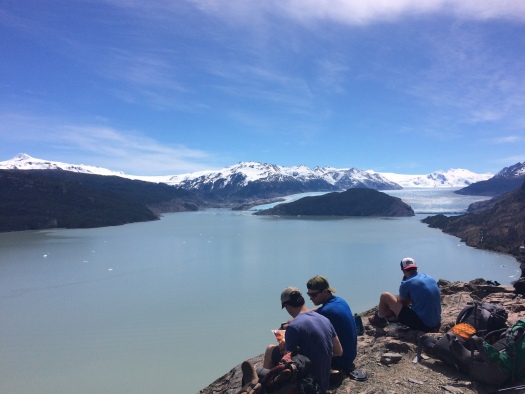
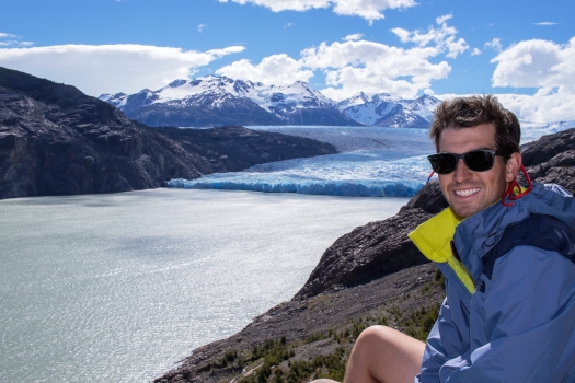
The second half of this hike offers beautiful views of the lake and glacier, as you draw ever close to them. It’s hard to grasp the sheer size of the glacier, and it was all the more exciting knowing that we would get to hike out onto it the following morning.
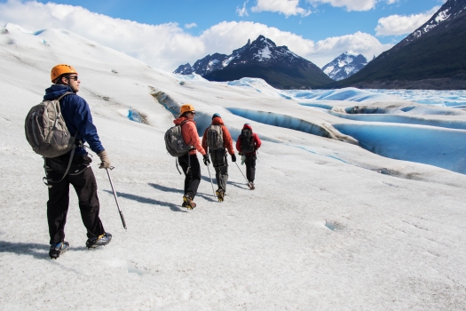
Day 2: Ice Hiking on Glacier Grey
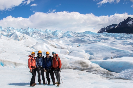
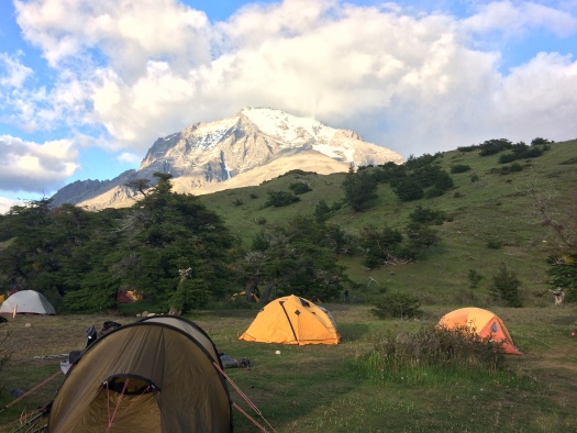
We rose around 6:30 AM on our first morning of camping, which wasn’t hard considering sunrise was close to 5:30. After heating up some surprisingly yummy dehydrated breakfasts, we made our way up the trail to Big Foot Patagonia, the company who operates both kayaking trips and ice hiking tours of the glacier. We were joined by one other couple on our tour, and the 6 of us set our with our guide.
After a short boat ride, we disembarked and began a hike across a rocky trail that led us toward the glacier. As we made the hike, our guide explained just how much recession the glacier has seen in recent years. As recently as 2005, he explained, the entire trail we followed to the base of the glacier was covered in ice. While the glacier is still massive, it’s hard not to feel a little sad at the effects we are having on our natural environment, particularly when faced with the destruction of something so pure and beautiful.
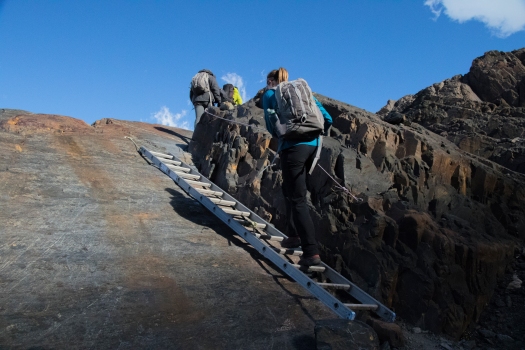
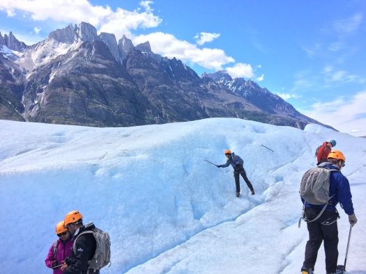
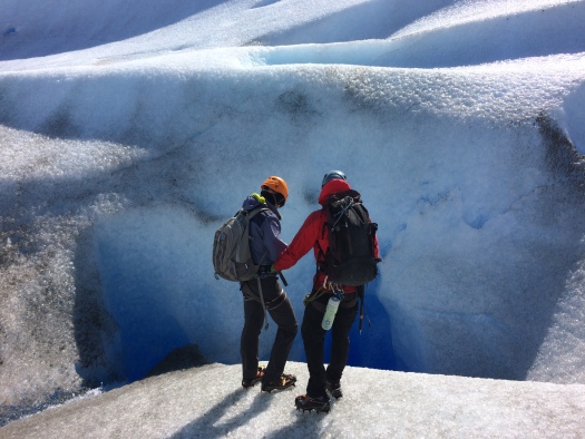
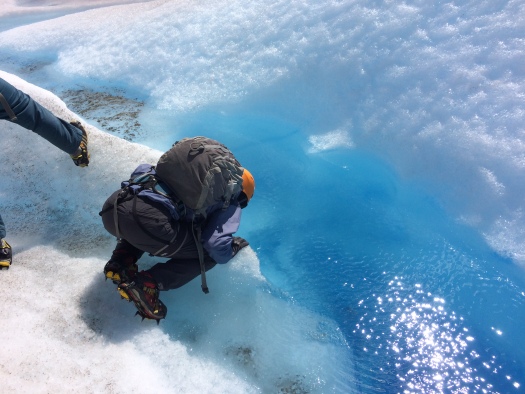
After about an hour of hiking, we finally reached ice. We paused here to gear up, putting on helmets, harnesses and cramp-ons (metal spikes that attach to the sole of your shoe to give you traction on the ice). With ice picks in hand, we set out for a walk along the glacier’s surface.
Words can’t describe how surreal and beautiful this hike was. We got lucky with a warm, sunny day. As we walked, our guide pointed out incredibly beautiful ice formations, and deep craters that form as the ice shifts and melts. The ice is so compacted in places, that it creates this incredibly bright blue color which I realized with a laugh, is the exact color of the Glacier Freeze Gatorade I used to bring to volleyball practice.
After the hike, we headed back to camp to relax for awhile. We had a big couple of days ahead of us, so didn’t want to tire ourselves out, but Matt and I decided to take a short hike out to an overlook point a little further along the trail. With the sun still shining brightly, it was well worth the walk for another vantage point of the glacier.
Day 3: Glacier Grey to the French Valley
Day 3 got off to another early start. We broke down camp and ate a hot breakfast, and were back on the trail by 7. We retraced our steps from day 1, taking a few last glances over our shoulders as Glacier Grey got smaller and smaller in the distance
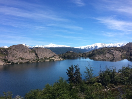
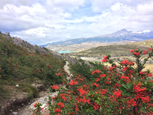
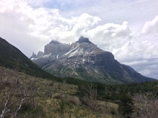
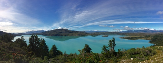
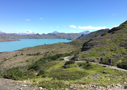
After making it back to our original starting point and stopping for a snack, we set out to break new ground. Weather wise, this was the cloudiest day we saw, with a few bouts of light rain as we made our way toward the French Valley. Despite the rain, the hike was beautiful. The trail lead us by sparkling turquoise lakes and toward enormous craggy mountain peaks called Los Cuernos or in English, The Horns.
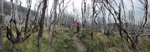
 We also passed through some wooded areas, including a forest that had seen devastating damage during a recent wildfire. Walking through this expanse of charred trees was eerie, and put into perspective just how important preservation is in Patagonia.
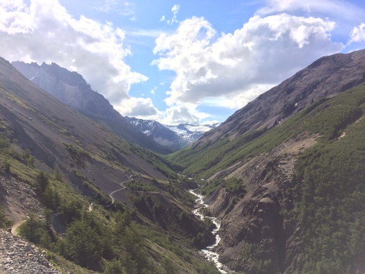
After making it to campsite #2, which was located along the river at the base of the French Valley, I headed out solo to to do a bit more hiking. We had already traversed about 10 miles of trail, but this would be our only opportunity to explore the French Valley itself so, despite heavy legs, I couldn’t resist. I didn’t make it all the way to the top of the overlook, which would have been 3 hours each way, but did make it to an impressive overlook point part way up and got to see an avalanche take place on the large glacier across the valley.
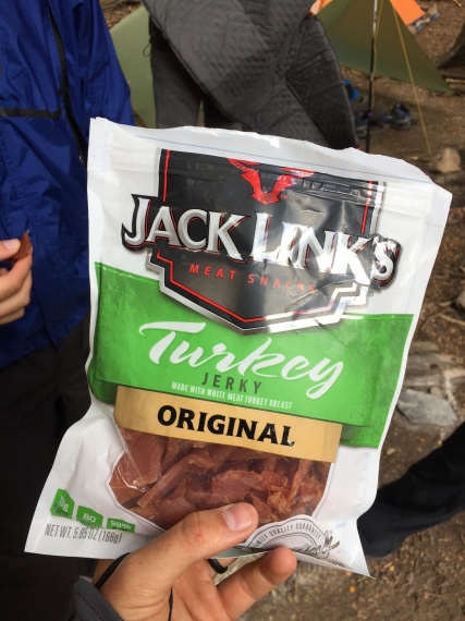
We finished off day 3 by celebrating Thanksgiving with more dehydrated meals and some Turkey Jerkey. It wasn’t quite the Thanksgiving feast we’re used to back home, but with 3 days of beautiful hiking under our belts, and 2 more to go, we had no complaints.
Day 4: The French Valley to Camping Chileno
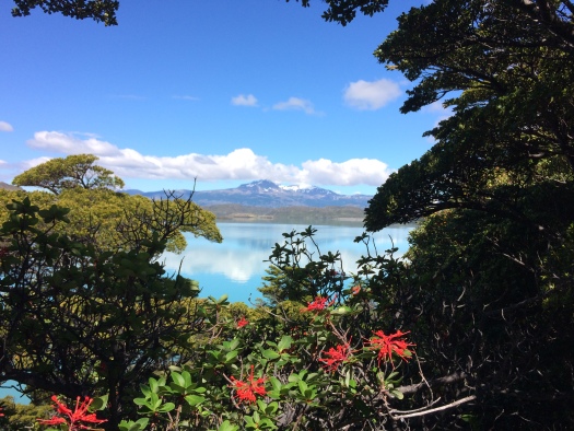
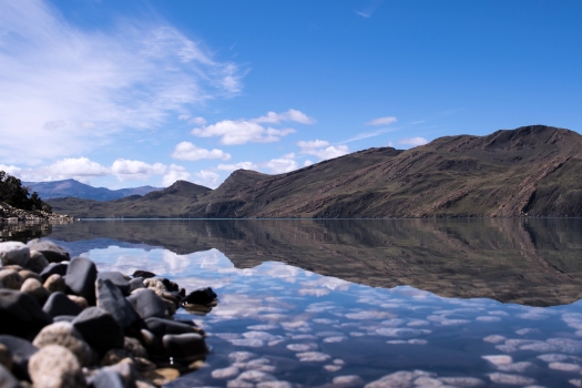
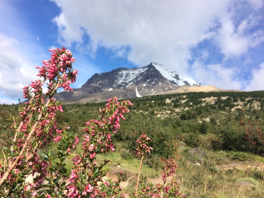
Day 4 was, in my opinion, both the toughest and most beautiful day of the trek. We exited the French Valley, and spent most of the morning walking above and alongside the breathtakingly beautiful Lago Nordenskjöld. Photos truly can’t capture how beautiful this hike was, with something incredible in every direction. Shimmering turquoise waters, grey craggy mountain peaks, massive glaciers, and colorful wildflowers were around every corner, and I could hardly stop myself from stopping every 10 feet to comment on just how beautiful it all was.
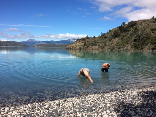
At one point, the trail takes you down to a rocky beach right on the lake shore. The boys wanted to take a quick (freezing) swim, and I didn’t argue since none of them had showered since we left Puerto Natales. As they let their shirts dry, we relaxed on the beach. This was one of the most peaceful, beautiful spots I’ve ever been. It was like the background scene on one of those apps that makes calming, nature sounds. Sometimes, when life starts to get chaotic again, I close my eyes and picture myself in this spot.
The last couple hours of this hike were a pretty steady uphill and after a day of carrying our packs it was definitely challenging. The “W” in general doesn’t have many steep inclines, and without packs this ascent wouldn’t have been terribly challenging, but we were feeling the effects of the last 4 days by this point.
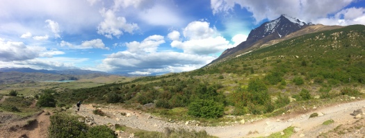
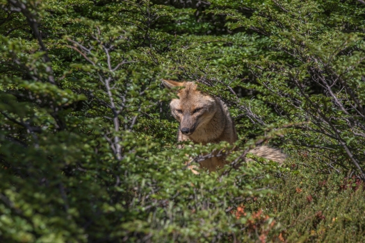
Finally, though, we rounded the corner and headed into Ascencio Valley, the third and final valley of our trek. Though we were tired, it was hard not to marvel all over again at the beauty of this valley. Fortunately, the last stretch was mostly flat before we headed back downhill to camp. We arrived in time to have a beer, take a hot shower (well, at least one of us) and spot some Patagonian wildlife before falling asleep to the sound of the rushing river.
Day 5: Las Torres
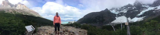
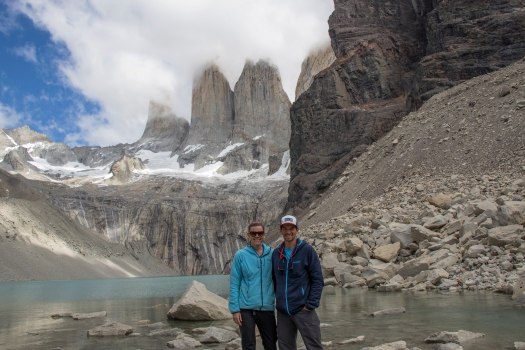
On the final full day of our hike, we set off on the uphill hike to the base of Las Torres, the three iconic towers that give the park it’s name. While the hike from our campsite to the torres was the most incline we had seen, we were able to do it without our packs, which made the ascent much more pleasant.
Because of their altitude and the ever changing Patagonian weather, they say there is typically only a 50% chance that you will see the torres, as they are often shrouded in a thick layer of clouds. Though it was a sunny day, some clouds had rolled in by the time we reached the top. Even still, as they rolled through, we got some spectacular views.
We made our way back to camp by mid-afternoon, where we picked up a boxed lunch prepared by the camp site’s lodge. We relaxed awhile longer by the riverbed before pulling on our packs one last time to make the final trek back out to the base of the “W” and our final campsite.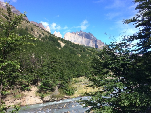
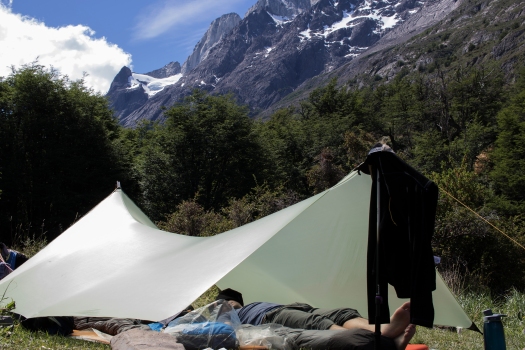
After a mostly downhill hike out of the valley to the outskirts of the park, we arrived and set up camp for our final night. Throughout the trek, we got incredibly lucky with weather, with clear skies and virtually no winds (we read lots of stories about tent poles snapping and people nearly blowing off the trail). On our last night, Andrew and Michael, who had been tarp camping throughout the trip, decided to sleep under the stars.
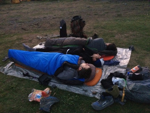
For my part, despite the clear skies, I didn’t see a single star during the entire trip. Not because they weren’t visible, but simply because I couldn’t seem to find myself awake while it was dark. We were so far south, that the sun didn’t set until after 10PM, with dusk lingering well past 11.
Day 6 & 7: Camping Las Torres to Puerto Natales and back to Santiago
On our final morning in the park, we found ourselves with quite a bit of time on our hands. The first bus out of the park doesn’t leave until 2PM, so we had the morning to relax at camp, and take in the last of the incredible mountain views.
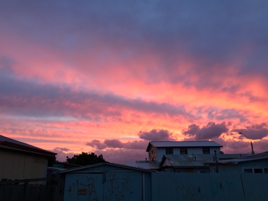
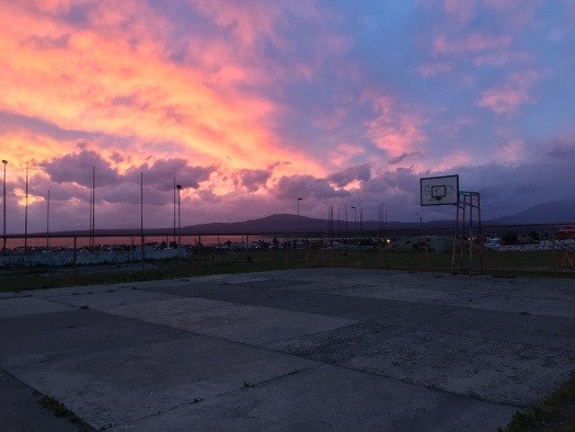
From there, we began the long journey home. A bus took us back to Puerto Natales, where we spent the night, made friends with some friendly street dogs, and watched an incredible sunset light up the sky at 10PM. The following day, we took another bus to Punta Arenas, driving alongside the Straights of Magellan, before finally landing back in Santiago.
There is no way a blog post, even one full of photos, can do justice to this trek. It’s not easy to get to, but if you ever get the chance, it’s well worth the journey. Until next time!
Wow what a trip! Thanks for posting Lauren
Sounds amazing! I am going to hike the W this year too, so excited. May I ask you which kind of camara did you use?
Thanks, it was a great trip – you will love it! The photos here were taken both on my iPhone 5s, and on a Canon 7D Camera. The scenery was so incredibly that even my old iPhone held it’s own in trying to capture it. But, of course, nothing is as good as seeing it with your own eyes – enjoy!